Geolocate

Mérignac topographic map

Click on the map to display elevation.

About this map
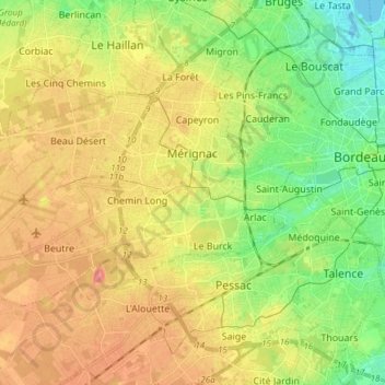
Name: Mérignac topographic map, elevation, terrain.

Location: Mérignac, Bordeaux, Gironde, Nouvelle-Aquitaine, Metropolitan France, 33700, France (44.79984 -0.75698 44.86278 -0.60694)

Average elevation: 34 m

Minimum elevation: -3 m

Maximum elevation: 70 m

Other topographic maps

Click on a map to view its topography, its elevation and its terrain.

Cité du Quillet

France > Nouvelle-Aquitaine > Gironde > Bazas

Average elevation: 102 m

Gear up for your next adventure:

🔥Camping Stove - Portable stoves to cook outdoors with ease
🔋Emergency Crank Radio - Weather alerts and power without needing batteries
🧥Fleece Jacket - Warm and lightweight jacket for layering
🚲MTB Frame Bag - Carry tools and maps directly on your bicycle frame
🧥Softshell Jacket - Windproof and breathable jacket for hiking

As an Amazon Associate, this site earns from qualifying purchases at no extra cost to you.