
Staten Island topographic map
Interactive map
Click on the map to display elevation.
About this map
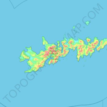
Name: Staten Island topographic map, elevation, terrain.
Location: Staten Island, Departamento Ushuaia, TDF, 9410, Argentina (-54.91652 -64.75776 -54.71307 -63.79571)
Average elevation: 23 m
Minimum elevation: -1 m
Maximum elevation: 779 m