
Kowloon City District topographic map
Interactive map
Click on the map to display elevation.
About this map
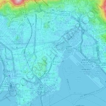
Name: Kowloon City District topographic map, elevation, terrain.
Location: Kowloon City District, Kowloon, Hong Kong, 000000, China (22.29411 114.17273 22.34933 114.21938)
Average elevation: 37 m
Minimum elevation: -31 m
Maximum elevation: 438 m
Other topographic maps
Click on a map to view its topography, its elevation and its terrain.
Sham Shui Po District
Sham Shui Po District, Kowloon, Hong Kong, China
Average elevation: 58 m