
Thank you for supporting this site ❤️
Make a donation
Make a donation
Gear up for your next adventure:
As an Amazon Associate, this site earns from qualifying purchases at no extra cost to you.
Miranda topographic map
Click on the map to display elevation.
Thank you for supporting this site ❤️
Make a donation
Make a donation
Gear up for your next adventure:
As an Amazon Associate, this site earns from qualifying purchases at no extra cost to you.
About this map
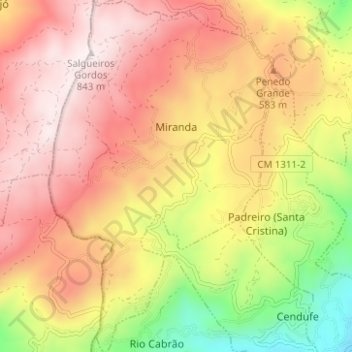
Name: Miranda topographic map, elevation, terrain.
Location: Miranda, Arcos de Valdevez, Viana do Castelo, North, Portugal (41.80824 -8.53101 41.85466 -8.48777)
Average elevation: 500 m
Minimum elevation: 42 m
Maximum elevation: 836 m
Thank you for supporting this site ❤️
Make a donation
Make a donation
Gear up for your next adventure:
As an Amazon Associate, this site earns from qualifying purchases at no extra cost to you.