Geolocate

Loreto topographic map

Click on the map to display elevation.

About this map
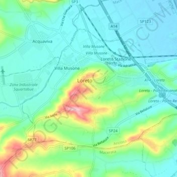
Name: Loreto topographic map, elevation, terrain.

Location: Loreto, Ancona, 60025, Italy (43.41729 13.57894 43.45632 13.65862)

Average elevation: 44 m

Minimum elevation: -2 m

Maximum elevation: 194 m

Gear up for your next adventure:

⛺Lightweight Camping Tent - Portable shelter optimized for Canadian backcountry camping
🥾Lightweight Hiking Shoes - Comfortable shoes for day hikes
🐕Hiking Dog Pack - Let your canine companion carry their own water and food
💡Compact LED Flashlight - Powerful and portable flashlight for outdoor use
🥾Waterproof Hiking Boots - Boots keeping your feet dry in wet conditions

As an Amazon Associate, this site earns from qualifying purchases at no extra cost to you.