Geolocate

Spilsby topographic map

Click on the map to display elevation.

About this map

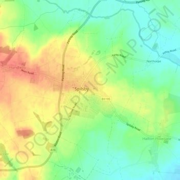
Name: Spilsby topographic map, elevation, terrain.

Location: Spilsby, East Lindsey, Lincolnshire, England, United Kingdom (53.15708 0.07455 53.18923 0.11795)

Average elevation: 32 m

Minimum elevation: 8 m

Maximum elevation: 58 m

Other topographic maps

Click on a map to view its topography, its elevation and its terrain.

Gear up for your next adventure:

🥾Hiking Leggings - Comfortable leggings for outdoor activities
👟Leg Gaiters - Keep debris, mud, and snow out of your boots
🥾Hiking Shoes - Durable and comfortable shoes for trail hiking
🔨Vehicle Emergency Tool - Safety tool for remote road trips to trailheads
🥽Outdoor Goggles - Protective eyewear for outdoor activities

As an Amazon Associate, this site earns from qualifying purchases at no extra cost to you.