Geolocate

Felixstowe topographic map

Click on the map to display elevation.

About this map

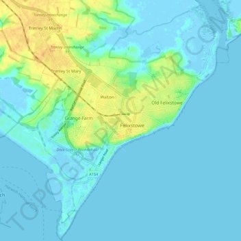
Name: Felixstowe topographic map, elevation, terrain.

Location: Felixstowe, East Suffolk, Suffolk, England, United Kingdom (51.93176 1.29598 51.99866 1.39285)

Average elevation: 6 m

Minimum elevation: -4 m

Maximum elevation: 28 m

Gear up for your next adventure:

💡Portable Camping Lamp - Rechargeable lamp for campsite lighting
💧Collapsible Water Bottle - Space-saving water bottle for outdoor activities
🥾Hiking Shorts - Breathable shorts suitable for summer hikes
🧥Waterproof Hiking Jacket - Protect yourself from rain and wind while hiking
🧳Compression Sacks - Maximize space in your backpack by shrinking gear

As an Amazon Associate, this site earns from qualifying purchases at no extra cost to you.