Geolocate

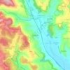
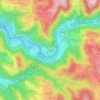
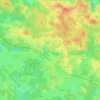
Nadillac topographic map

Click on the map to display elevation.

About this map

Name: Nadillac topographic map, elevation, terrain.

Location: Nadillac, Gourdon, Lot, Occitania, Metropolitan France, 46360, France (44.54261 1.48985 44.58815 1.52505)

Average elevation: 319 m

Minimum elevation: 179 m

Maximum elevation: 417 m

Other topographic maps

Click on a map to view its topography, its elevation and its terrain.
Flaujac-Haut

France > Occitania > Lot > Flaujac-Gare

Average elevation: 335 m

Bovila

France > Occitania > Lot > Porte-du-Quercy

Average elevation: 243 m

Labrousse

France > Occitania > Lot > Prayssac

Average elevation: 123 m

Mas Ponchet

France > Occitania > Lot > Cressensac-Sarrazac

Average elevation: 215 m

Les Vignottes

France > Occitania > Lot > Prendeignes

Average elevation: 373 m

Cournou

France > Occitania > Lot > Saint-Vincent-Rive-d'Olt

Average elevation: 243 m

Revers

France > Occitania > Lot > Le Vigan-en-Quercy

Average elevation: 262 m

Brugales

France > Occitania > Lot > Laval-de-Cère

Average elevation: 311 m

Saint-Esprit

France > Occitania > Lot > Martel

Average elevation: 239 m

Concots

France > Occitania > Lot > Concots > Concots

Average elevation: 268 m

Les Boules

France > Occitania > Lot > Bellefont-La Rauze

Average elevation: 276 m

Gear up for your next adventure:

⛺Backpacking Tent - Lightweight tent for long-distance hiking trips
🥾All-Terrain Hiking Boots - Versatile boots for varied hiking conditions
🥤Collapsible Travel Cup - Saves space and weight in your mess kit
🧦Thermal Socks - Warm socks for winter hiking or camping
🧥Thermal Layer - Insulating layer for cold outdoor conditions

As an Amazon Associate, this site earns from qualifying purchases at no extra cost to you.