Geolocate

Victoria topographic map

Click on the map to display elevation.

About this map

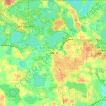
Name: Victoria topographic map, elevation, terrain.

Location: Victoria, Carver County, Minnesota, 55386, United States (44.82533 -93.69297 44.89141 -93.62037)

Average elevation: 298 m

Minimum elevation: 277 m

Maximum elevation: 323 m

Gear up for your next adventure:

🥾Light Hiking Boots - Lightweight and comfortable boots for day hikes
🥾Light Trekking Boots - Supportive boots for multi-day treks
🥾Hiking Boots - Sturdy boots providing ankle support and traction on rugged trails
🥾Hiking Leggings - Comfortable leggings for outdoor activities
🕶️Polarized Sunglasses - Reduces glare from snow and water at high elevations

As an Amazon Associate, this site earns from qualifying purchases at no extra cost to you.