Sauerland topographic map
Click on the map to display elevation.
Sauerland
To the west the hills continue into the Bergisches Land, to the south into the Siegerland, and to the north-east into the Teutoburg Forest. The major rivers of the Sauerland are the Ruhr and the Lenne. Several artificial lakes were created on the smaller rivers by building dams to store water for the nearby Ruhr area, the biggest reservoirs being the Möhne and Bigge. Although the highest elevation of the Sauerland is the Langenberg (843 m) near Olsberg, the much more renowned summit, which is well known for the nearby skiing facilities, its weather station and observation tower, is the slightly lower Kahler Asten (842 m) near Winterberg. Both Langenberg and Kahler Asten are peaks in the Rothaargebirge mountains.
About this map
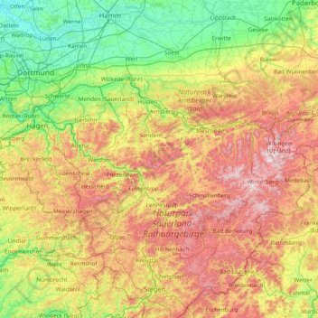
Name: Sauerland topographic map, elevation, terrain.
Location: Sauerland, North Rhine – Westphalia, Germany (50.92129 7.42669 51.59645 8.92098)
Average elevation: 316 m
Minimum elevation: 41 m
Maximum elevation: 844 m
Other topographic maps
Click on a map to view its topography, its elevation and its terrain.