Geolocate

Montabaur topographic map

Click on the map to display elevation.

About this map
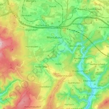
Name: Montabaur topographic map, elevation, terrain.

Location: Montabaur, Westerwaldkreis, Rhineland-Palatinate, Germany (50.38320 7.72773 50.45710 7.88655)

Average elevation: 302 m

Minimum elevation: 154 m

Maximum elevation: 543 m

Gear up for your next adventure:

🧴Waterproofing Spray - Restore the DWR coating on jackets and tents
🛶Waterproof Dry Bags - Keep electronics and clothes dry during river crossings
💡LED Camping Lantern - Illuminate your campsite with long-lasting lanterns
🧤Thermal Hiking Gloves - Grip-enhanced gloves for cold-weather altitude trekking
🥾Hiking Gaiters - Protect legs and shoes from mud, snow, and debris

As an Amazon Associate, this site earns from qualifying purchases at no extra cost to you.