Geolocate

O Cabo topographic map

Click on the map to display elevation.

About this map

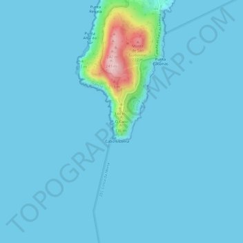
Name: O Cabo topographic map, elevation, terrain.

Location: O Cabo, Fisterra, A Coruña, Galicia, 15155, Spain (42.86329 -9.29180 42.90329 -9.25180)

Average elevation: 15 m

Minimum elevation: -1 m

Maximum elevation: 234 m

Gear up for your next adventure:

🧦Crew Hiking Socks - Comfortable socks for long-distance hikes
🧰Survival Kit - Essential gear for emergencies in the wilderness
🌬️Windproof Camp Stove - Efficient cooking even on exposed mountain peaks
🛌Down Sleeping Bag - Superior warmth-to-weight ratio for cold nights
🪑Insulated Seat Pad - Protect your seat from cold rocks and wet logs

As an Amazon Associate, this site earns from qualifying purchases at no extra cost to you.