Geolocate

Las Acacias topographic map

Click on the map to display elevation.

About this map

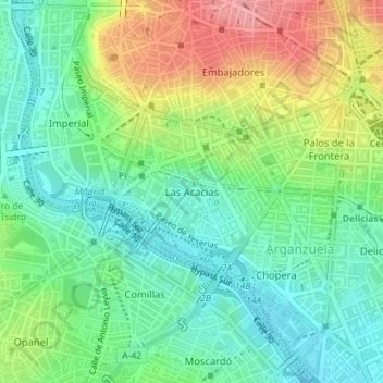
Name: Las Acacias topographic map, elevation, terrain.

Location: Las Acacias, Arganzuela, Madrid, Community of Madrid, Spain (40.39523 -3.71490 40.40669 -3.69921)

Average elevation: 607 m

Minimum elevation: 570 m

Maximum elevation: 672 m

Other topographic maps

Click on a map to view its topography, its elevation and its terrain.

Madrid

Spain > Community of Madrid > Madrid

Average elevation: 650 m

Gear up for your next adventure:

🧢Hiking Sun Hat - Wide-brimmed protection for exposed mountain ridges
🧢Outdoor Cap - Protective cap for sun and rain during hikes
🎒Backpack Rain Cover - External shield to keep your entire pack dry
🛁Quick-Dry Microfiber Towel - Space-saving towel that dries rapidly on the move
🛏️Camping Sleeping Mat - Comfortable mats for sleeping outdoors

As an Amazon Associate, this site earns from qualifying purchases at no extra cost to you.