Geolocate

Falset topographic map

Click on the map to display elevation.

About this map
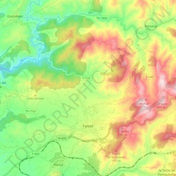
Name: Falset topographic map, elevation, terrain.

Location: Falset, Priorat, Tarragona, Catalonia, 43730, Spain (41.13386 0.76068 41.18959 0.86337)

Average elevation: 361 m

Minimum elevation: 122 m

Maximum elevation: 668 m

Other topographic maps

Click on a map to view its topography, its elevation and its terrain.
Gratallops

Spain > Catalonia > Priorat > Gratallops > Gratallops

Average elevation: 255 m

Gear up for your next adventure:

🛌Insulated Sleeping Pad - Critical thermal barrier between you and the cold ground
🧥Waterproof Pants - Keep dry during rainy hiking conditions
🔦LED Flashlight - Powerful and long-lasting flashlight for camping and emergencies
🥾Light Trekking Boots - Supportive boots for multi-day treks
🥾Mountaineering Boots - Supportive boots for climbing and high-altitude hiking

As an Amazon Associate, this site earns from qualifying purchases at no extra cost to you.