Geolocate

Bateas topographic map

Click on the map to display elevation.

About this map

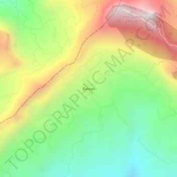
Name: Bateas topographic map, elevation, terrain.

Location: Bateas, Tibacuy, Sumapaz, RAP (Especial) Central, Colombia (4.29777 -74.53509 4.33777 -74.49509)

Average elevation: 1,353 m

Minimum elevation: 803 m

Maximum elevation: 2,102 m

Gear up for your next adventure:

🥘Camping Cookware Set - Compact nesting pots and pans for trail cooking
🕯️Camping Lantern - Illuminates your entire campsite with high-efficiency LEDs
🧥Insulated Jacket - Keep warm in cold outdoor conditions
🔦LED Headlamp - Hands-free lighting for early morning starts or late finishes
🧭GPS Handheld Device - Reliable GPS navigation for outdoor adventures

As an Amazon Associate, this site earns from qualifying purchases at no extra cost to you.