
Roeselare topographic map
Interactive map
Click on the map to display elevation.
About this map
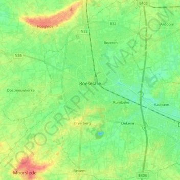
Name: Roeselare topographic map, elevation, terrain.
Location: Roeselare, West Flanders, Flanders, 8800, Belgium (50.88701 3.06191 50.99403 3.17849)
Average elevation: 25 m
Minimum elevation: 7 m
Maximum elevation: 55 m