Geolocate

Butler topographic map

Click on the map to display elevation.

About this map

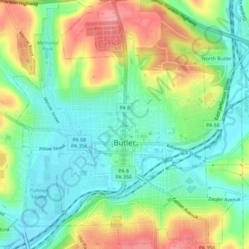
Name: Butler topographic map, elevation, terrain.

Location: Butler, Butler County, Pennsylvania, 16003, United States (40.84766 -79.91395 40.87910 -79.87570)

Average elevation: 339 m

Minimum elevation: 299 m

Maximum elevation: 405 m

Gear up for your next adventure:

🥾Trail Hiking Socks - Comfortable socks to prevent blisters and fatigue
🧴Outdoor Sunscreen - High SPF protection for high-altitude UV exposure
🧭GPS Outdoor Watch - Smart watch for navigation and fitness tracking in nature
🥾Trekking Boots - Durable boots for long-distance trekking
🔦LED Headlamp - Hands-free lighting for early morning starts or late finishes

As an Amazon Associate, this site earns from qualifying purchases at no extra cost to you.