Geolocate

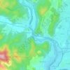
Sommières topographic map

Click on the map to display elevation.

About this map
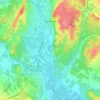
Name: Sommières topographic map, elevation, terrain.

Location: Sommières, Nîmes, Gard, Occitania, Metropolitan France, 30250, France (43.74973 4.05128 43.79161 4.11106)

Average elevation: 48 m

Minimum elevation: 18 m

Maximum elevation: 104 m

Other topographic maps

Click on a map to view its topography, its elevation and its terrain.

Esparon

France > Occitania > Gard > Bez-et-Esparon

Average elevation: 522 m

Mas Berthaud

France > Occitania > Gard > Saint-Gilles

Average elevation: 4 m

Les Mazes

France > Occitania > Gard > Village de Sérignac

Average elevation: 94 m

Les Brousses

France > Occitania > Gard > Molières-sur-Cèze

Average elevation: 293 m

Mont Aigoual

France > Occitania > Gard > Val-d'Aigoual

Average elevation: 1,355 m

la Croix

France > Occitania > Gard > Argilliers > Argilliers

Average elevation: 91 m

Escalade

France > Occitania > Gard > Sumène

Average elevation: 372 m

Camp Bernard

France > Occitania > Gard > Val-d'Aigoual > Fenouillet

Average elevation: 636 m

Le Soulier

France > Occitania > Gard > Saint-Martin-de-Valgalgues

Average elevation: 202 m

Bay

France > Occitania > Gard > Canaules-et-Argentières

Average elevation: 98 m

Le Fageas

France > Occitania > Gard > L'Estréchure

Average elevation: 854 m

Gear up for your next adventure:

💡Compact LED Flashlight - Powerful and portable flashlight for outdoor use
🎒Hiking Daypack - Lightweight and durable backpacks for day trips and excursions
🧥Waterproof Jacket - Lightweight rain jackets for hiking and outdoor activities
🧥Insulated Jacket - Keep warm in cold outdoor conditions
🔭Outdoor Binoculars - Lightweight binoculars for birdwatching and hiking

As an Amazon Associate, this site earns from qualifying purchases at no extra cost to you.