Geolocate

Ennis topographic map

Click on the map to display elevation.

About this map

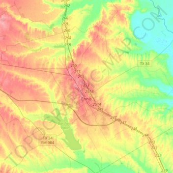
Name: Ennis topographic map, elevation, terrain.

Location: Ennis, Ellis County, Texas, 75119, United States (32.26156 -96.76000 32.43431 -96.44661)

Average elevation: 136 m

Minimum elevation: 98 m

Maximum elevation: 176 m

Gear up for your next adventure:

🥾Trail Running Shoes - Lightweight and durable shoes for trail running
🧼Travel Hand Sanitizer - Keep hands clean when water is scarce
🔥Emergency Fire Starter - Reliable ignition source for all weather conditions
🌬️Windproof Camp Stove - Efficient cooking even on exposed mountain peaks
🍽️Titanium Camping Spork - Ultralight and indestructible eating utensil

As an Amazon Associate, this site earns from qualifying purchases at no extra cost to you.