Geolocate

Monroe topographic map

Click on the map to display elevation.

About this map
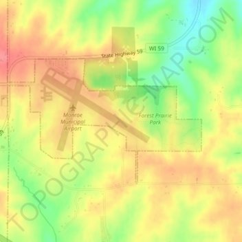
Name: Monroe topographic map, elevation, terrain.

Location: Monroe, Green County, Wisconsin, United States (42.60678 -89.60242 42.62073 -89.57297)

Average elevation: 312 m

Minimum elevation: 269 m

Maximum elevation: 343 m

Gear up for your next adventure:

⛺Camping Essentials - All-in-one gear for a comfortable camping trip
🧭Orienteering Kit - Tools for map reading and navigation in the wild
🧥Waterproof Pants - Keep dry during rainy hiking conditions
🧥Softshell Hiking Jacket - The perfect balance of wind protection and breathability
🥘Camping Cookware Set - Compact nesting pots and pans for trail cooking

As an Amazon Associate, this site earns from qualifying purchases at no extra cost to you.