Geolocate

Virajpet topographic map

Click on the map to display elevation.

About this map

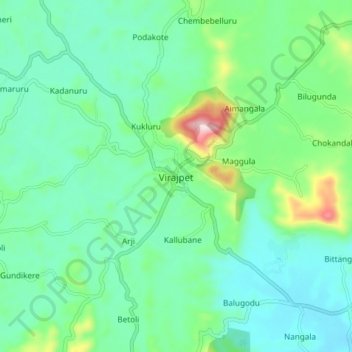
Name: Virajpet topographic map, elevation, terrain.

Location: Virajpet, Virajpet taluk, Kodagu, Karnataka, 571218, India (12.15727 75.76334 12.23727 75.84334)

Average elevation: 899 m

Minimum elevation: 820 m

Maximum elevation: 1,163 m

Gear up for your next adventure:

🥾Light Trekking Boots - Supportive boots for multi-day treks
🔦LED Flashlight - Powerful and long-lasting flashlight for camping and emergencies
🔦LED Headtorch - Bright and durable light for night activities
🛌Down Sleeping Bag - Superior warmth-to-weight ratio for cold nights
🪑Ultralight Camping Stool - Compact seating for rest stops during long hikes

As an Amazon Associate, this site earns from qualifying purchases at no extra cost to you.