Geolocate

Brevard topographic map

Click on the map to display elevation.

About this map

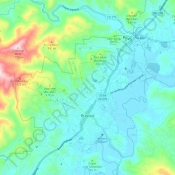
Name: Brevard topographic map, elevation, terrain.

Location: Brevard, Transylvania County, North Carolina, United States (35.20933 -82.79070 35.28541 -82.68419)

Average elevation: 745 m

Minimum elevation: 633 m

Maximum elevation: 1,167 m

Other topographic maps

Click on a map to view its topography, its elevation and its terrain.

Gear up for your next adventure:

🧥Softshell Jacket - Windproof and breathable jacket for hiking
🧶550 Survival Paracord - Versatile utility cord for emergency repairs and rigging
💡Portable Camping Lamp - Rechargeable lamp for campsite lighting
🪜Heavy Duty Carabiners - Multi-use clips for securing gear to your backpack
🥾Waterproof Trail Shoes - Shoes designed to handle wet terrain

As an Amazon Associate, this site earns from qualifying purchases at no extra cost to you.