

Petrolina topographic map
Click on the map to display elevation.
Petrolina
Petrolina is situated on the left (northern) bank of the São Francisco River, in the interior semi-arid Sertão subregion, at an elevation of 376 m. On the other side of the river sits Juazeiro, in state of Bahia, and together the cities form an integrated metropolitan area. The two cities, making up an urban area of almost 700,000 people, are connected by the President Dutra Bridge. The Sobradinho Dam is located 26 km up river, and creates the Sobradinho Reservoir, the 34th largest reservoir by volume in the world.
About this map
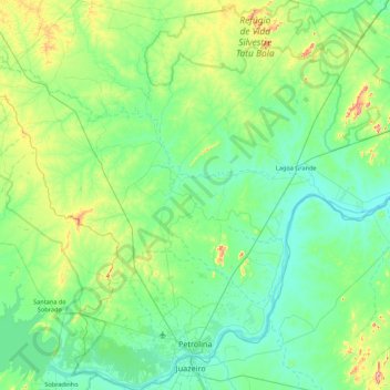
Name: Petrolina topographic map, elevation, terrain.
Average elevation: 420 m
Minimum elevation: 349 m
Maximum elevation: 740 m
Other topographic maps
Click on a map to view its topography, its elevation and its terrain.
Boa Paz
Brazil > Pernambuco > Região Administrativa Integrada de Desenvolvimento do Polo Petrolina e Juazeiro > Petrolina
Average elevation: 379 m