Geolocate

Bitburg topographic map

Click on the map to display elevation.

About this map
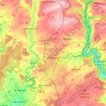
Name: Bitburg topographic map, elevation, terrain.

Location: Bitburg, Eifelkreis Bitburg-Prüm, Rhineland-Palatinate, Germany (49.93519 6.45161 50.01873 6.58925)

Average elevation: 326 m

Minimum elevation: 202 m

Maximum elevation: 416 m

Gear up for your next adventure:

👟Trail Running Shoes - Agile footwear for fast-paced topographic exploration
🛁Quick-Dry Microfiber Towel - Space-saving towel that dries rapidly on the move
🔦LED Headtorch - Bright and durable light for night activities
🧭GPS Handheld Device - Reliable GPS navigation for outdoor adventures
🏃Hydration Running Vest - Carry water and maps close to your body for speed

As an Amazon Associate, this site earns from qualifying purchases at no extra cost to you.