
Thank you for supporting this site ❤️
Make a donation
Make a donation
Gear up for your next adventure:
As an Amazon Associate, this site earns from qualifying purchases at no extra cost to you.
Duns topographic map
Click on the map to display elevation.
Thank you for supporting this site ❤️
Make a donation
Make a donation
Gear up for your next adventure:
As an Amazon Associate, this site earns from qualifying purchases at no extra cost to you.
About this map
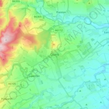
Name: Duns topographic map, elevation, terrain.
Location: Duns, Berwickshire, Scotland, TD11 3DR, United Kingdom (55.73784 -2.38385 55.81784 -2.30385)
Average elevation: 130 m
Minimum elevation: 59 m
Maximum elevation: 353 m
Thank you for supporting this site ❤️
Make a donation
Make a donation
Gear up for your next adventure:
As an Amazon Associate, this site earns from qualifying purchases at no extra cost to you.