Geolocate

Prairieville topographic map

Click on the map to display elevation.

Prairieville

Prairieville's latitude is 30.302N, and the longitude is -90.971W. The elevation is 23 feet (7.0 m).

About this map

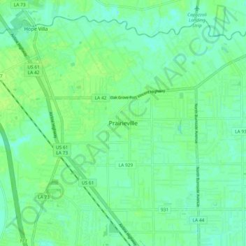
Name: Prairieville topographic map, elevation, terrain.

Location: Prairieville, Ascension Parish, Louisiana, 70769, United States (30.27225 -90.98973 30.35225 -90.90973)

Average elevation: 7 m

Minimum elevation: 1 m

Maximum elevation: 12 m

Gear up for your next adventure:

🧥Insulated Jacket - Keep warm in cold outdoor conditions
🧦Thermal Socks - Warm socks for winter hiking or camping
📷Outdoor Action Camera - Capture high-elevation views and rugged adventures
Camping Coffee Maker - Brew fresh coffee anywhere on the topographic map
🎒Hiking Daypack - Lightweight and durable backpacks for day trips and excursions

As an Amazon Associate, this site earns from qualifying purchases at no extra cost to you.