Geolocate

El Escorial topographic map

Click on the map to display elevation.

About this map

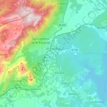
Name: El Escorial topographic map, elevation, terrain.

Location: El Escorial, Community of Madrid, Spain (40.51892 -4.15972 40.63745 -4.03292)

Average elevation: 1,057 m

Minimum elevation: 825 m

Maximum elevation: 1,755 m

Other topographic maps

Click on a map to view its topography, its elevation and its terrain.

Monte de El Pardo

Spain > Community of Madrid

Average elevation: 689 m

Gear up for your next adventure:

🛌Insulated Sleeping Pad - Critical thermal barrier between you and the cold ground
🛏️Camping Sleeping Mat - Comfortable mats for sleeping outdoors
🧢Beanie Hat - Keep your head warm in cold weather
🧭GPS Outdoor Watch - Smart watch for navigation and fitness tracking in nature
🕯️Camping Lantern - Illuminates your entire campsite with high-efficiency LEDs

As an Amazon Associate, this site earns from qualifying purchases at no extra cost to you.