

Wetzlar topographic map
Click on the map to display elevation.
Wetzlar
Wetzlar has a year-round temperate seasonal climate of the middle latitudes. Between the different elevations there are different small climatic conditions. The daily mean temperature in summer is about 17 to 18 °C (63 to 64 °F) and in winter about 1 to 2 °C (34 to 36 °F). The average rainfall is 600 to 700 mm (24 to 28 in), slightly below the German national average. On the high ground to the south and north of the Lahn valley there is a rainfall of 800 mm (31 in) which is exactly the national average. The wettest months are June and December, with 74 mm (2.9 in) and 73.3 mm (2.9 in), the driest month is February with 49.1 mm (1.9 in).
About this map
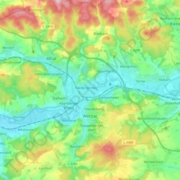
Name: Wetzlar topographic map, elevation, terrain.
Location: Wetzlar, Lahn-Dill-Kreis, Hesse, Germany (50.50772 8.44355 50.63340 8.61894)
Average elevation: 232 m
Minimum elevation: 141 m
Maximum elevation: 426 m