Geolocate

Curicó topographic map

Click on the map to display elevation.

About this map

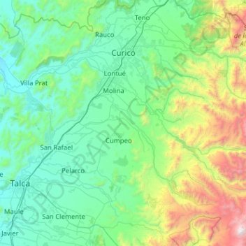
Name: Curicó topographic map, elevation, terrain.

Location: Curicó, Provincia de Curicó, Maule Region, Chile (-35.55953 -71.38359 -34.88813 -70.36789)

Average elevation: 658 m

Minimum elevation: 39 m

Maximum elevation: 3,922 m

Gear up for your next adventure:

🥾Hiking Gaiters - Protect legs and shoes from mud, snow, and debris
🧣Evaporative Cooling Towel - Beat the heat during intense summer climbs
🥾Trail Hiking Socks - Comfortable socks to prevent blisters and fatigue
🔨Vehicle Emergency Tool - Safety tool for remote road trips to trailheads
🥤Collapsible Travel Cup - Saves space and weight in your mess kit

As an Amazon Associate, this site earns from qualifying purchases at no extra cost to you.