Geolocate

Marneuli topographic map

Click on the map to display elevation.

About this map

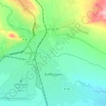
Name: Marneuli topographic map, elevation, terrain.

Location: Marneuli, Marneuli Municipality, Lower Kartli, 3000, Georgia (41.45614 44.79152 41.49601 44.83598)

Average elevation: 407 m

Minimum elevation: 377 m

Maximum elevation: 503 m

Gear up for your next adventure:

🥾Approach Shoes - Shoes designed for climbing approaches and rugged trails
🥾Trail Running Shoes - Lightweight and durable shoes for trail running
🧥Packable Rain Jacket - Breathable waterproof layer for unpredictable weather
Bushcraft Tarp - Versatile emergency shelter or gear protection
🧴Bear Spray Holster - Quick-access carry for essential Canadian wilderness safety

As an Amazon Associate, this site earns from qualifying purchases at no extra cost to you.