Geolocate

Helena topographic map

Click on the map to display elevation.

About this map
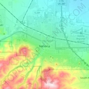
Name: Helena topographic map, elevation, terrain.

Location: Helena, Lewis and Clark County, Montana, United States (46.55922 -112.08328 46.62948 -111.93522)

Average elevation: 1,301 m

Minimum elevation: 1,127 m

Maximum elevation: 1,741 m

Other topographic maps

Click on a map to view its topography, its elevation and its terrain.

Marysville

United States > Montana > Lewis and Clark County

Average elevation: 1,795 m

Gear up for your next adventure:

🧊Insulated Water Bottle - Keeps drinks cold in summer and prevents freezing in winter
💡LED Camping Lantern - Illuminate your campsite with long-lasting lanterns
🎒Fully Waterproof Backpack - Total protection for photography gear and electronics
🧦Hiking Liner Socks - Thin base layer to prevent friction and blisters
🎒Hiking Daypack - Lightweight and durable backpacks for day trips and excursions

As an Amazon Associate, this site earns from qualifying purchases at no extra cost to you.