
Leganés topographic map
Click on the map to display elevation.
About this map
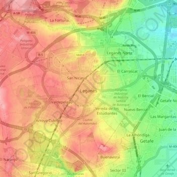
Name: Leganés topographic map, elevation, terrain.
Location: Leganés, Community of Madrid, Spain (40.29249 -3.81844 40.36555 -3.72089)
Average elevation: 656 m
Minimum elevation: 597 m
Maximum elevation: 704 m
Other topographic maps
Click on a map to view its topography, its elevation and its terrain.
Madrid
Spain > Community of Madrid > Área metropolitana de Madrid y Corredor del Henares > Madrid
Average elevation: 650 m