
Encañada topographic map
Click on the map to display elevation.
Encañada
One of the highest elevations of the district is the Llusk'a Qullpa mountain range at approximately 4,000 m (13,000 ft) on the border with the Namora District. Other mountains are listed below.
About this map
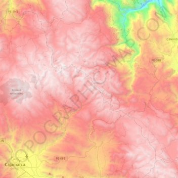
Name: Encañada topographic map, elevation, terrain.
Location: Encañada, Province of Cajamarca, Cajamarca, Peru (-7.16532 -78.60175 -6.79894 -78.18369)
Average elevation: 3,421 m
Minimum elevation: 1,518 m
Maximum elevation: 4,244 m
Other topographic maps
Click on a map to view its topography, its elevation and its terrain.