Geolocate

Regoufe topographic map

Click on the map to display elevation.

About this map

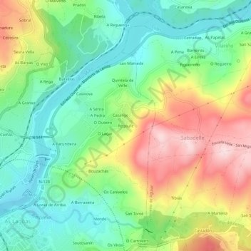
Name: Regoufe topographic map, elevation, terrain.

Location: Regoufe, Velle, Ourense, Galicia, 32960, Spain (42.34262 -7.85298 42.38262 -7.81298)

Average elevation: 227 m

Minimum elevation: 92 m

Maximum elevation: 447 m

Gear up for your next adventure:

🐕Hiking Dog Pack - Let your canine companion carry their own water and food
Camping Tent - Weather-resistant tents suitable for 2 to 6 people
🕶️Polarized Sunglasses - Protect your eyes with durable polarized lenses
🚑Survival Whistle - Signal for help across long distances in mountains
🥾Trail Hiking Shoes - Durable shoes designed for rugged trails

As an Amazon Associate, this site earns from qualifying purchases at no extra cost to you.