

Shillong topographic map
Click on the map to display elevation.
Shillong
HQ Eastern Air Command (HQ, EAC) was shifted to Shillong on 10 June 1963 from Kolkata and housed in the old buildings located at Nonglyer village at Upper Shillong, some 10 km (6.2 mi) from (Lower) Shillong, but at a greater altitude of around 1,800 metres (6,000 ft) AMSL. Initially a British military base, it was taken over by No. 58 Gorkha Regiment of the Indian Army post Independence in 1947. The Regiment was redeployed after the Sino-Indian War of 1962, making way for the IAF to step in. Only helicopters can operate from HQ, EAC, using a 12.7-hectare (31-acre) helipad.
About this map
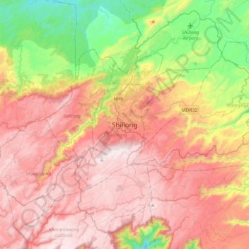
Name: Shillong topographic map, elevation, terrain.
Location: Shillong, Mylliem, East Khasi Hills, Meghalaya, 793001, India (25.41599 91.72279 25.73599 92.04279)
Average elevation: 1,351 m
Minimum elevation: 659 m
Maximum elevation: 1,958 m