
Sierra County topographic map
Interactive map
Click on the map to display elevation.
About this map
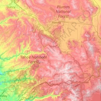
Name: Sierra County topographic map, elevation, terrain.
Location: Sierra County, California, United States (39.39171 -121.05816 39.77689 -120.00111)
Average elevation: 1,690 m
Minimum elevation: 539 m
Maximum elevation: 2,762 m
Prior to the California Gold Rush, the area was home to both the Maidu and the Washoe peoples. They generally summered in the higher elevations to hunt and fish, and returned to lower elevations for the winter months. After the discovery of gold in the Sierra foothills sparked the California Gold Rush, more than 16,000 miners settled in Sierra County between 1848 and 1860. Most mining settlements in the county sprung up along the North and Middle Forks of the Yuba River, both of which had rich deposits of gold. While some of the mining boom towns faded away once gold fever died down, other settlements such as Downieville and Sierra City have remained.