Geolocate

Regensburg topographic map

Click on the map to display elevation.

About this map

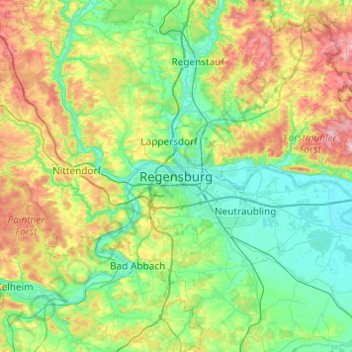
Name: Regensburg topographic map, elevation, terrain.

Location: Regensburg, Upper Palatinate, Bavaria, 93047, Germany (48.85953 11.93749 49.17953 12.25749)

Average elevation: 406 m

Minimum elevation: 323 m

Maximum elevation: 616 m

Gear up for your next adventure:

🧴Outdoor Sunscreen - High SPF protection for high-altitude UV exposure
🔨Vehicle Emergency Tool - Safety tool for remote road trips to trailheads
🥘Camping Cookware Set - Compact nesting pots and pans for trail cooking
🥾Waterproof Hiking Boots - Essential footwear for rugged terrain and wet Canadian trails
🎒Backpack Rain Cover - External shield to keep your entire pack dry

As an Amazon Associate, this site earns from qualifying purchases at no extra cost to you.