Geolocate

Marchampt topographic map

Click on the map to display elevation.

About this map
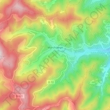
Name: Marchampt topographic map, elevation, terrain.

Location: Marchampt, Villefranche-sur-Saône, Rhône, Auvergne-Rhône-Alpes, Metropolitan France, 69430, France (46.08307 4.53001 46.13420 4.59270)

Average elevation: 544 m

Minimum elevation: 284 m

Maximum elevation: 836 m

Other topographic maps

Click on a map to view its topography, its elevation and its terrain.
Fondrieu

France > Auvergne-Rhône-Alpes > Rhône > Rontalon

Average elevation: 493 m

Le Bourg

France > Auvergne-Rhône-Alpes > Rhône > Juliénas

Average elevation: 316 m

Gear up for your next adventure:

🥾Mountain Hiking Boots - High-traction boots for rocky terrain
🧰Emergency Multi-Tool - Compact multi-tool for outdoor survival
🛶Canoe Life Vest - Safety vest for water sports
🦟Insect Repellent - Keep mosquitoes and black flies away in wooded areas
🧤Thermal Hiking Gloves - Grip-enhanced gloves for cold-weather altitude trekking

As an Amazon Associate, this site earns from qualifying purchases at no extra cost to you.