Geolocate

Adel topographic map

Click on the map to display elevation.

About this map

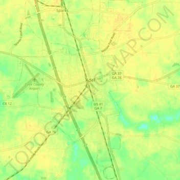
Name: Adel topographic map, elevation, terrain.

Location: Adel, Cook County, Georgia, 31620, United States (31.09444 -83.46221 31.17117 -83.39735)

Average elevation: 72 m

Minimum elevation: 57 m

Maximum elevation: 79 m

Gear up for your next adventure:

Camping Coffee Maker - Brew fresh coffee anywhere on the topographic map
🥾Trekking Poles - Adjustable trekking poles to reduce knee stress and improve stability
🥾Hiking Gaiters - Protect legs and shoes from mud, snow, and debris
🧢Hiking Sun Hat - Wide-brimmed protection for exposed mountain ridges
🧥Waterproof Jacket - Lightweight rain jackets for hiking and outdoor activities

As an Amazon Associate, this site earns from qualifying purchases at no extra cost to you.