Geolocate

Hammarstrand topographic map

Click on the map to display elevation.

About this map

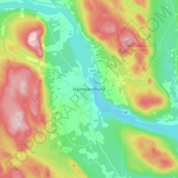
Name: Hammarstrand topographic map, elevation, terrain.

Location: Hammarstrand, Ragunda kommun, Jämtland County, 844 31, Sweden (63.06858 16.31584 63.14858 16.39584)

Average elevation: 231 m

Minimum elevation: 103 m

Maximum elevation: 444 m

Gear up for your next adventure:

🧢Hiking Hat - Sun-protective and breathable hats for long treks
🧥Waterproof Jacket - Lightweight rain jackets for hiking and outdoor activities
🧭GPS Handheld Device - Reliable GPS navigation for outdoor adventures
🛶Waterproof Dry Bags - Keep electronics and clothes dry during river crossings
🧢Beanie Hat - Keep your head warm in cold weather

As an Amazon Associate, this site earns from qualifying purchases at no extra cost to you.