Geolocate

Yigo Municipality topographic map

Click on the map to display elevation.

About this map
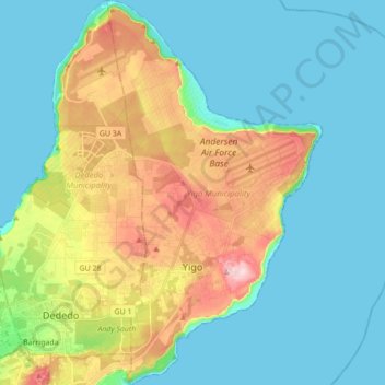
Name: Yigo Municipality topographic map, elevation, terrain.

Location: Yigo Municipality, Guam, United States (13.48598 144.85977 13.65438 144.95696)

Average elevation: 70 m

Minimum elevation: 0 m

Maximum elevation: 251 m

Other topographic maps

Click on a map to view its topography, its elevation and its terrain.
Gear up for your next adventure:

💧Filtered Water Bottle - Safe drinking water on the go
🧴Sunscreen SPF - Broad-spectrum sunscreen for outdoor activities
⛺Camping Groundsheet - Protect your tent from moisture and dirt
🧢Beanie Hat - Keep your head warm in cold weather
🔦LED Flashlight - Powerful and long-lasting flashlight for camping and emergencies

As an Amazon Associate, this site earns from qualifying purchases at no extra cost to you.