Geolocate

Nendaz topographic map

Click on the map to display elevation.

About this map

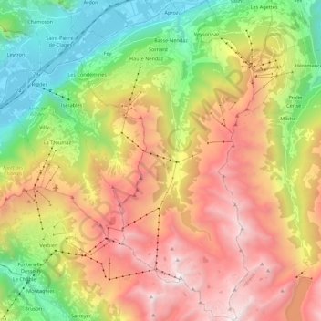
Name: Nendaz topographic map, elevation, terrain.

Location: Nendaz, Conthey, Wallis, 1997, Switzerland (46.06054 7.24951 46.21142 7.36854)

Average elevation: 1,771 m

Minimum elevation: 465 m

Maximum elevation: 3,319 m

Gear up for your next adventure:

🛶Kayak Dry Bag - Waterproof storage for kayaking adventures
🧳Compression Sacks - Maximize space in your backpack by shrinking gear
🔦UV Flashlight - Detect minerals or specific insects in the dark
🌡️Emergency Mylar Blankets - Compact thermal protection for unexpected nights outdoors
🛁Quick-Dry Microfiber Towel - Space-saving towel that dries rapidly on the move

As an Amazon Associate, this site earns from qualifying purchases at no extra cost to you.