Geolocate

Mount Helen topographic map

Click on the map to display elevation.

About this map

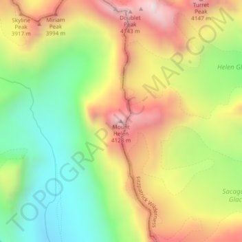
Name: Mount Helen topographic map, elevation, terrain.

Location: Mount Helen, Sublette County, Wyoming, United States (43.15101 -109.63103 43.15111 -109.63093)

Average elevation: 3,681 m

Minimum elevation: 3,248 m

Maximum elevation: 4,177 m

Other topographic maps

Click on a map to view its topography, its elevation and its terrain.

Boulter Lake

United States > Wyoming > Sublette County

Average elevation: 2,885 m

Gear up for your next adventure:

🧦Hiking Liner Socks - Thin base layer to prevent friction and blisters
🥾Trekking Boots - Durable boots for long-distance trekking
🥾Mountain Hiking Boots - High-traction boots for rocky terrain
🛶Waterproof Dry Bags - Keep electronics and clothes dry during river crossings
🕶️Polarized Sunglasses - Protect your eyes with durable polarized lenses

As an Amazon Associate, this site earns from qualifying purchases at no extra cost to you.