Geolocate

Owasso topographic map

Click on the map to display elevation.

About this map

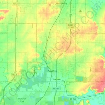
Name: Owasso topographic map, elevation, terrain.

Location: Owasso, Tulsa County, Oklahoma, 74055, United States (36.24886 -95.90201 36.33668 -95.70774)

Average elevation: 199 m

Minimum elevation: 163 m

Maximum elevation: 250 m

Other topographic maps

Click on a map to view its topography, its elevation and its terrain.

Turley

United States > Oklahoma > Tulsa County

Average elevation: 206 m

Southern Reserve

United States > Oklahoma > Tulsa County > Jenks

Average elevation: 197 m

Gear up for your next adventure:

❄️Traction Ice Cleats - Slip-on spikes for icy trails and winter hiking
🛶Canoe Life Vest - Safety vest for water sports
🕶️Polarized Sunglasses - Reduces glare from snow and water at high elevations
🔭Compact Binoculars - Lightweight optics for scouting trails and wildlife
💡Portable Camping Lamp - Rechargeable lamp for campsite lighting

As an Amazon Associate, this site earns from qualifying purchases at no extra cost to you.