Geolocate

Bad Saarow topographic map

Click on the map to display elevation.

About this map
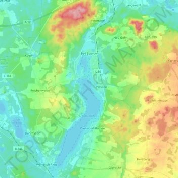
Name: Bad Saarow topographic map, elevation, terrain.

Location: Bad Saarow, Scharmützelsee, Oder-Spree, Brandenburg, Germany (52.20332 14.00768 52.32992 14.11748)

Average elevation: 68 m

Minimum elevation: 34 m

Maximum elevation: 148 m

Other topographic maps

Click on a map to view its topography, its elevation and its terrain.
Karutzhöhe

Germany > Brandenburg > Oder-Spree > Erkner

Average elevation: 37 m

Gear up for your next adventure:

🔭Compact Monocular - One-handed bird watching and trail spotting
🧴First Aid Kit - Essential first aid supplies for outdoor emergencies
⛺Backpacking Tent - Lightweight tent for long-distance hiking trips
🥾Light Hiking Boots - Lightweight and comfortable boots for day hikes
🥾Lightweight Hiking Boots - Boots for comfort and mobility on long hikes

As an Amazon Associate, this site earns from qualifying purchases at no extra cost to you.