
Thank you for supporting this site ❤️
Make a donation
Make a donation
Gear up for your next adventure:
As an Amazon Associate, this site earns from qualifying purchases at no extra cost to you.
Luarca / Ḷḷuarca topographic map
Click on the map to display elevation.
Thank you for supporting this site ❤️
Make a donation
Make a donation
Gear up for your next adventure:
As an Amazon Associate, this site earns from qualifying purchases at no extra cost to you.
About this map
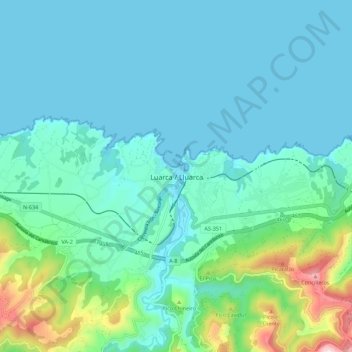
Name: Luarca / Ḷḷuarca topographic map, elevation, terrain.
Location: Luarca / Ḷḷuarca, Valdés, 33700, Spain (43.50390 -6.57574 43.58390 -6.49574)
Average elevation: 94 m
Minimum elevation: 0 m
Maximum elevation: 555 m
Thank you for supporting this site ❤️
Make a donation
Make a donation
Gear up for your next adventure:
As an Amazon Associate, this site earns from qualifying purchases at no extra cost to you.