
Thank you for supporting this site ❤️
Make a donation
Make a donation
Gear up for your next adventure:
As an Amazon Associate, this site earns from qualifying purchases at no extra cost to you.
Baniyari topographic map
Click on the map to display elevation.
Thank you for supporting this site ❤️
Make a donation
Make a donation
Gear up for your next adventure:
As an Amazon Associate, this site earns from qualifying purchases at no extra cost to you.
About this map
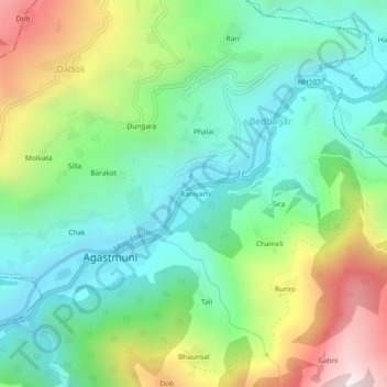
Name: Baniyari topographic map, elevation, terrain.
Location: Baniyari, Agastmuni, Rudraprayag, Uttarakhand, 246421, India (30.37853 79.01606 30.41853 79.05606)
Average elevation: 1,150 m
Minimum elevation: 754 m
Maximum elevation: 1,957 m
Thank you for supporting this site ❤️
Make a donation
Make a donation
Gear up for your next adventure:
As an Amazon Associate, this site earns from qualifying purchases at no extra cost to you.