
Thank you for supporting this site ❤️
Make a donation
Make a donation
Gear up for your next adventure:
As an Amazon Associate, this site earns from qualifying purchases at no extra cost to you.
Marneuli topographic map
Click on the map to display elevation.
Thank you for supporting this site ❤️
Make a donation
Make a donation
Gear up for your next adventure:
As an Amazon Associate, this site earns from qualifying purchases at no extra cost to you.
About this map
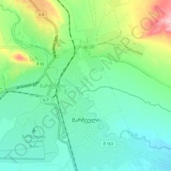
Name: Marneuli topographic map, elevation, terrain.
Location: Marneuli, Marneuli Municipality, Lower Kartli, 3000, Georgia (41.45614 44.79152 41.49601 44.83598)
Average elevation: 407 m
Minimum elevation: 377 m
Maximum elevation: 503 m
Thank you for supporting this site ❤️
Make a donation
Make a donation
Gear up for your next adventure:
As an Amazon Associate, this site earns from qualifying purchases at no extra cost to you.