Geolocate

Gypsum topographic map

Click on the map to display elevation.

About this map

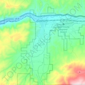
Name: Gypsum topographic map, elevation, terrain.

Location: Gypsum, Eagle County, Colorado, United States (39.57983 -106.97270 39.65827 -106.83238)

Average elevation: 2,174 m

Minimum elevation: 1,892 m

Maximum elevation: 3,005 m

Other topographic maps

Click on a map to view its topography, its elevation and its terrain.

Beaver Creek

United States > Colorado > Eagle County

Average elevation: 2,604 m

Hells Gate

United States > Colorado > Eagle County

Average elevation: 2,174 m

Gear up for your next adventure:

🧶550 Survival Paracord - Versatile utility cord for emergency repairs and rigging
💡LED Camping Lantern - Illuminate your campsite with long-lasting lanterns
🧦Merino Wool Socks - Moisture-wicking comfort for long-distance hiking
👖Convertible Hiking Pants - Zip-off legs to adapt to changing weather conditions
🧥Softshell Hiking Jacket - The perfect balance of wind protection and breathability

As an Amazon Associate, this site earns from qualifying purchases at no extra cost to you.