
Ibadan North East topographic map
Interactive map
Click on the map to display elevation.
About this map
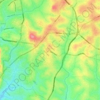
Name: Ibadan North East topographic map, elevation, terrain.
Location: Ibadan North East, Oyo State, Nigeria (7.36419 3.89879 7.42318 3.94390)
Average elevation: 219 m
Minimum elevation: 170 m
Maximum elevation: 277 m
Other topographic maps
Click on a map to view its topography, its elevation and its terrain.
Ibapon
Nigeria > Oyo State > Ogbomosho South
Ibapon, Ogbomosho South, Oyo State, Nigeria
Average elevation: 305 m
Ogbomosho
Nigeria > Oyo State > Ogbomosho North
Ogbomosho, Ogbomosho North, Oyo State, 210271, Nigeria
Average elevation: 352 m
Ibadan
Nigeria > Oyo State > Ibadan South West
Ibadan, Ibadan South West, Oyo State, 234102, Nigeria
Average elevation: 191 m